
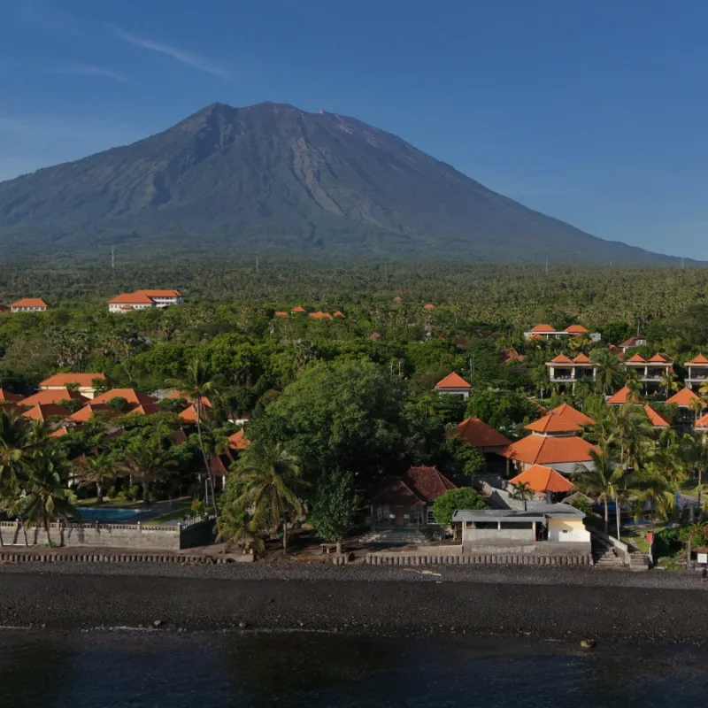
Indonesia sits right in the Pacific Ring of Fire. Bali is home to active volcanoes and experiences earthquakes on a regular basis.
Seismic activity is a normal part of day-to-day life in Indonesia and something that all tourists must be aware of when they travel to the region.


Indonesia’s Mount Semeru in Lumajang, East Java, has been experiencing increasing volcanic activity. Given its relatively close proximity to Bali and international flight paths, the recent eruptions have been under close monitoring from aviation leaders nationwide, especially in Bali.
On Monday, 19th January, Mount Semeru recorded six eruptions, the largest of which sent lava and ash one kilometre up into the air. The first eruption was recorded at 12.22 am, followed by another just 14 minutes later, and another 14 minutes exactly after that. Three more eruptions were recorded in a slower succession around sunrise.
Mount Semeru Observation Post Officer, Liswanto, confirmed “The eruption with the highest height occurred at 5.19 am local time, with the height of the eruption column observed at around 1,000m above the peak, or 4,676 meters above sea level.”
He noted that the ash column was white to grey in colour with a moderate intensity towards the northeast. The eruption is considered active and ongoing. Liswanto confirmed that Mount Semeru, which is the highest peak on Java Island, remains on Alert Level III. The Center for Volcanology and Geological Disaster Mitigation (PVMBG) advised against hiking the volcano and keeping a minimum of 13km away from the summit.
Liswanto concluded, “Beyond that distance, the community should not carry out activities within 500 meters of the riverbank boundary along Besuk Kobokan because of the potential of being hit by the expansion of hot clouds, and lava flows up to a distance of 17km from the peak.”
Tourists traveling in Java have not been given additional travel advice regarding tourism in the area. The world-famous Tumpak Sewu Waterfall, which offers breathtaking views of the Javan forest, waterfall, and on a clear day Mount Semeru, remains open to the public.
Bali Airport and all airports in East Java remain open and operational, and no updates have been issued regarding a change in service capacity. Monday’s eruption on Mount Semeru is an all too timely reminder for tourists traveling to Bali. As Bali is located within the Pacific Ring of Fire, the risk of seismic activity is ever-present.
This is why it is absolutely essential that tourists take out full comprehensive travel insurance prior to their departure to Indonesia. Tourists must also read through their policy documents in detail to ensure they know what is and is not covered, and how to make a claim in the event of a travel emergency.
Ring of Fire Monitor
Volcano & Quake Update: What Tourists Need to Know. Tap for details.
Mount Semeru
East Java Eruptions
Tap for Status ↻Alert Level III
Activity: 6 eruptions recorded on Jan 19th. Ash column reached 1km high.
Restriction: Stay 13km away from the summit.
Travel Impact
Airports & Sites
Tap for Updates ↻All Clear
Flights: Bali (DPS) & East Java airports are OPEN.
Tourism: Tumpak Sewu Waterfall remains open to the public.
Earthquakes
Recent “Swarms”
Tap for Stats ↻Shaking Stats
2025 Total: 547 quakes (10 felt).
Jan ’26: 212 small “swarm” quakes recorded Jan 5-8.
Risk: Bali sits on 26 active fault lines.
Tourist Advice
Before You Fly
Tap for Rules ↻Get Insured
Mandatory: Seismic activity is normal here. Ensure your travel insurance covers natural disasters.
Check: Read the fine print on policy exclusions.
For context, the Bali Meteorology, Climatology, and Geophysics Agency (BBMKG) confirmed that Bali Province recorded 547 earthquakes in 2025.
The Head of the BBMKG, Cahyo Nugroho, spoke to reporters about the seismic activity data and what it could mean for local communities and tourists in 2026. He explained, “Of the total number of incidents, 10 of the earthquakes were felt.”


Seismic activity has already been shaking things up in and around Bali. Latest sata shows that between 5th and 8th January, Bali recorded 212 consecutive small magnitude tectonic earthquakes, referred to as swarms.

As a province, Bali lies along 26 local fault lines, all of which are active. The earthquake swarm was not felt on land, as the magnitudes ranged from 1.4 to 2.8 and the epicentres were between 10 and 47 kilometres from the coast. However, the situation has prompted local officials to call for increased public understanding and the need for better socialisation of disaster management protocols, and a need to run disaster response simulations on a regular basis.
Remove All Ads & Unlock All Articles… Sign up for The Bali Sun Premium


Plan Your Bali Holiday:
Book The Best English Speaking Drivers For Airport Transfers & Tours
Choose From Thousands of Bali Hotels, Resorts, and Hostels with Free Cancellation On Most Properties
Book Cheap Flights To Bali
Don’t Forget Travel Insurance That Covers Medical Expenses In Bali
For the latest Bali News & Debate Join our Facebook Community
SUBSCRIBE TO NEW POSTS
Enter your email address to subscribe to The Bali Sun’s latest breaking news, straight to your inbox.
Discover more from The Bali Sun
Subscribe to get the latest posts sent to your email.